
Obtenez gratuitement le prix de votre transport
1 lot à livrer
-
 Lot n° 2926
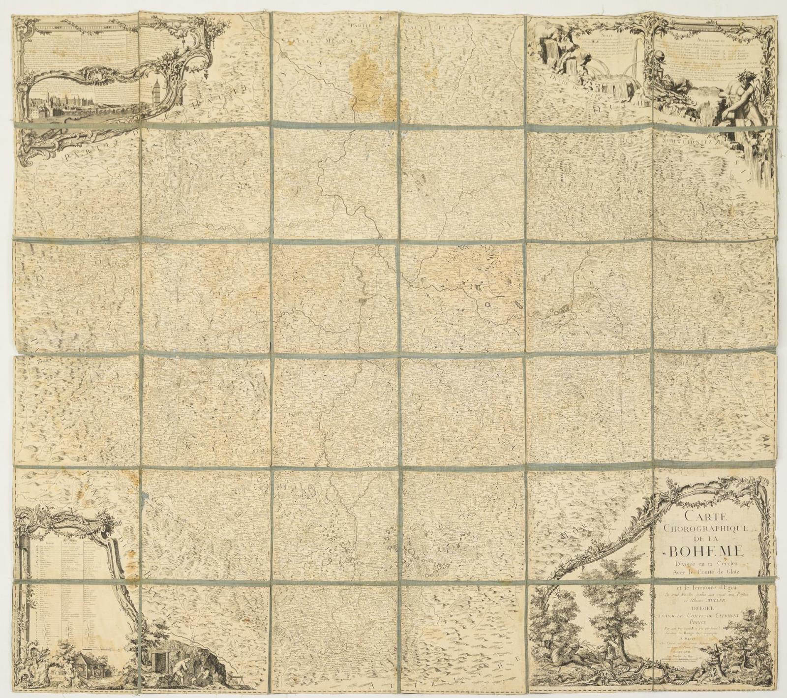
Außergewöhnlich große Landkarte "Charte Corographique de la Boheme" 1762. 145 x 166 cm / zusammengelegt: 27 x 24 cm. Böhmen mit Prag von Le Rouge. Segmentierte Karte, auf Leinen aufgezogen, vier große Kartuschen in den Ecken, unter anderem mit einer Ansicht von Prag. Von Plauen bis Otmachau und Pautzen (Bautzen) bis Freystatt. Altersspuren, etwas fleckig, kleine Fehlstellen. Aufrufzeit 20. | Juni 2026 | voraussichtlich 10:14 Uhr (CET) Exceptionally large map "Charte Corographique de la Boheme" 1762. 145 x 166 cm / folded: 27 x 24 cm. Bohemia with Prague by Le Rouge. Segmented map, mounted on linen, four large cartouches in the corners, including a view of Prague. From Plauen to Otmachau and Pautzen (Bautzen) to Freystatt. Signs of age, somewhat stained, small losses. Aufrufzeit 20. | June 2026 | probably 10:14 am (CET)*This is an automatically generated translation from German by deepl.com and only to be seen as an aid - not a legally binding declaration of lot properties. Please note that we can only guarantee for the correctness of description and condition as provided by the German description.
Lot n° 2926
Außergewöhnlich große Landkarte "Charte Corographique de la Boheme" 1762. 145 x 166 cm / zusammengelegt: 27 x 24 cm. Böhmen mit Prag von Le Rouge. Segmentierte Karte, auf Leinen aufgezogen, vier große Kartuschen in den Ecken, unter anderem mit einer Ansicht von Prag. Von Plauen bis Otmachau und Pautzen (Bautzen) bis Freystatt. Altersspuren, etwas fleckig, kleine Fehlstellen. Aufrufzeit 20. | Juni 2026 | voraussichtlich 10:14 Uhr (CET) Exceptionally large map "Charte Corographique de la Boheme" 1762. 145 x 166 cm / folded: 27 x 24 cm. Bohemia with Prague by Le Rouge. Segmented map, mounted on linen, four large cartouches in the corners, including a view of Prague. From Plauen to Otmachau and Pautzen (Bautzen) to Freystatt. Signs of age, somewhat stained, small losses. Aufrufzeit 20. | June 2026 | probably 10:14 am (CET)*This is an automatically generated translation from German by deepl.com and only to be seen as an aid - not a legally binding declaration of lot properties. Please note that we can only guarantee for the correctness of description and condition as provided by the German description.
Nous nous soucions de la protection de vos données. Lisez notre Politique de confidentialité.